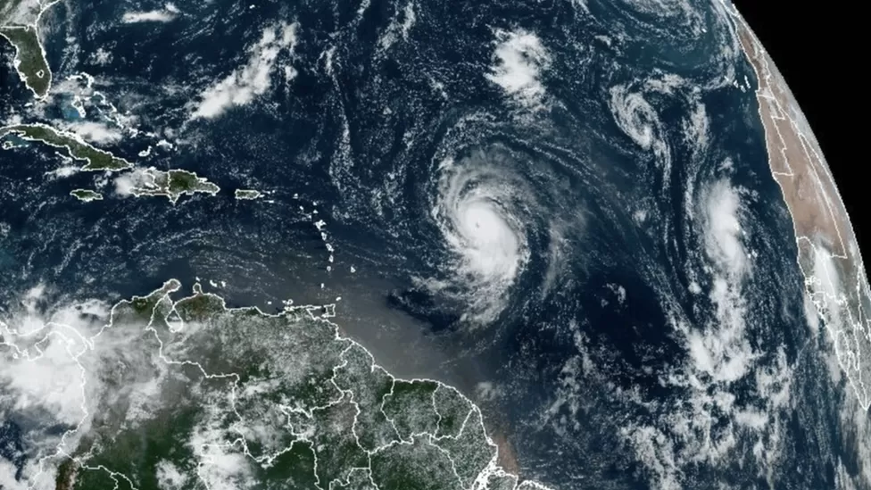
Hurricane Lee, the twelfth named storm of this year’s Atlantic hurricane season, has rapidly intensified into a Category 5 hurricane. The wind speeds up to 160mph (260km/h) as it barrels through the Caribbean.
The storm is not expected to make landfall on its current trajectory. However, the US National Hurricane Center (NHC) warned about dangerous beach conditions along the US East Coast on Sunday.
Hurricane Lee was initially a Category 1 storm, but it underwent a breathtaking transformation, intensifying into the current category. The NHC predicts that Lee will continue to strengthen overnight, although intensity fluctuations are anticipated in the coming days. Nevertheless, it is expected to remain a major hurricane well into the early part of next week.
The hurricane’s current path takes it through the Caribbean, posing a significant threat to the islands in its wake. As of Thursday evening, Hurricane Lee’s precise location placed it approximately 705 miles east of the northern Leeward Islands, at the intersection of the Caribbean and the Atlantic Ocean.
Hurricane Lee’s rapid development represents the unpredictability and potential of tropical storms during the Atlantic hurricane season, which typically spans from June to November. In recent years, the frequency and intensity of hurricanes have raised concerns among experts, highlighting the importance of preparedness and early warning systems.
In addition to Hurricane Lee, the Atlantic hurricane basin keeps an eye on the development of Tropical Storm Margot. Formerly known as Tropical Depression 14, Margot is forecasted to strengthen into a hurricane over the weekend while remaining over open water.
Meanwhile, in the Pacific Ocean, Hurricane Jova has seen a slight reduction in intensity, moving from a Category 5 to a Category 4 storm. Hurricane Jova is currently located far from southwestern Mexico and is not anticipated to make landfall in that region.
Experts predict that the 2023 Atlantic hurricane season is likely to be more active than usual. Climate change’s influence on the frequency of tropical storms is not definitively established. However, there is growing evidence that rising sea surface temperatures provide more energy for hurricanes, leading to increased intensity. Consequently, hurricanes are more likely to produce extreme rainfall and stronger winds due to the conditions associated with climate change.

